Skip to content
A forest seen from above, ending in a sharp line at a ploughed field

Proof that no forest was cleared here after 2020.

YourWeb EUDR is EUDR compliance software. It collects plot boundaries from your suppliers, checks every plot on satellite images and submits the due diligence statement (DDS) to TRACES. You decide only where it matters.

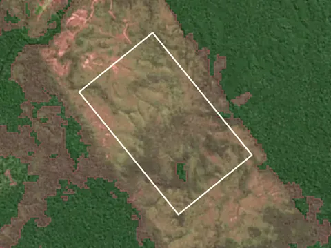
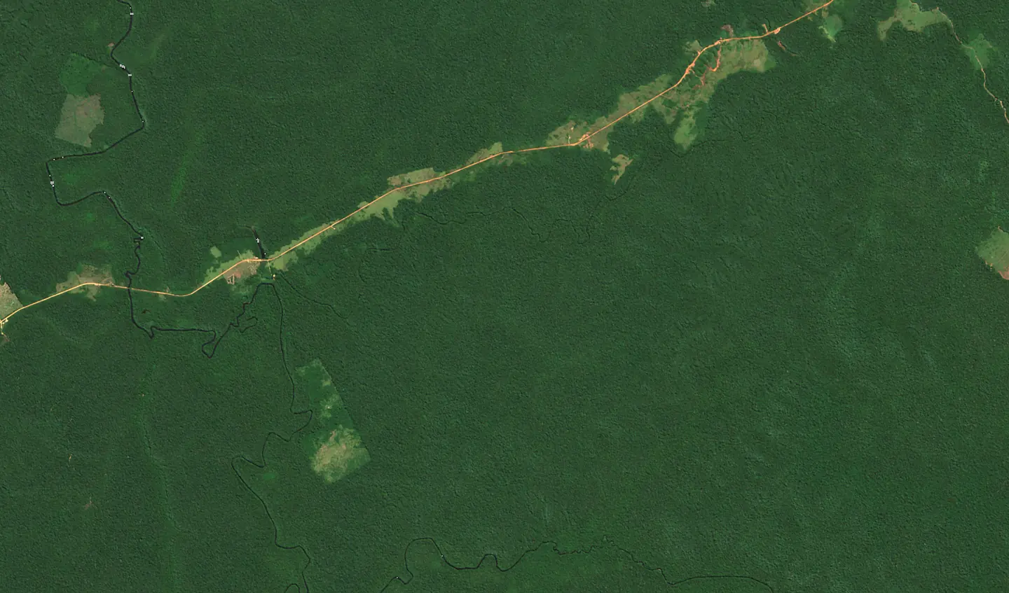
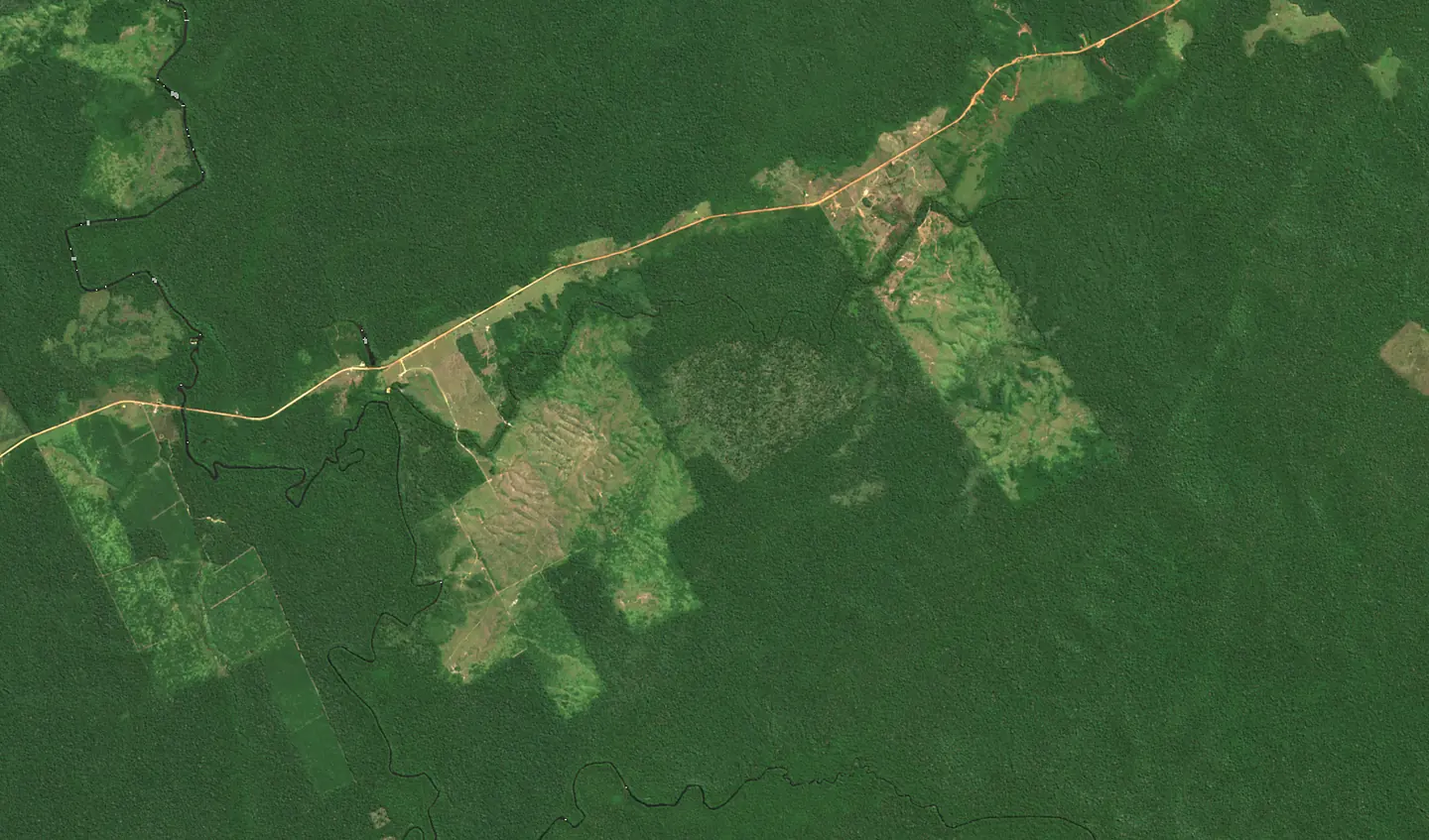
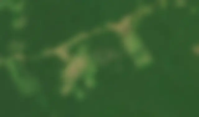
The same plot on satellite images from 2020 and 2026: forest, then clearing
Plot BR-AP-014, Brazil202.7 haof forest cleared in 2023. The panel found it on its own on Sentinel-2 images.
  • The EUDR applies from 30 December 2026
  • Micro and small companies: from 30 June 2027
  • Cut-off date: 31 December 2020
  • Maximum fine: at least 4% of EU turnover
  • Records kept for 5 years
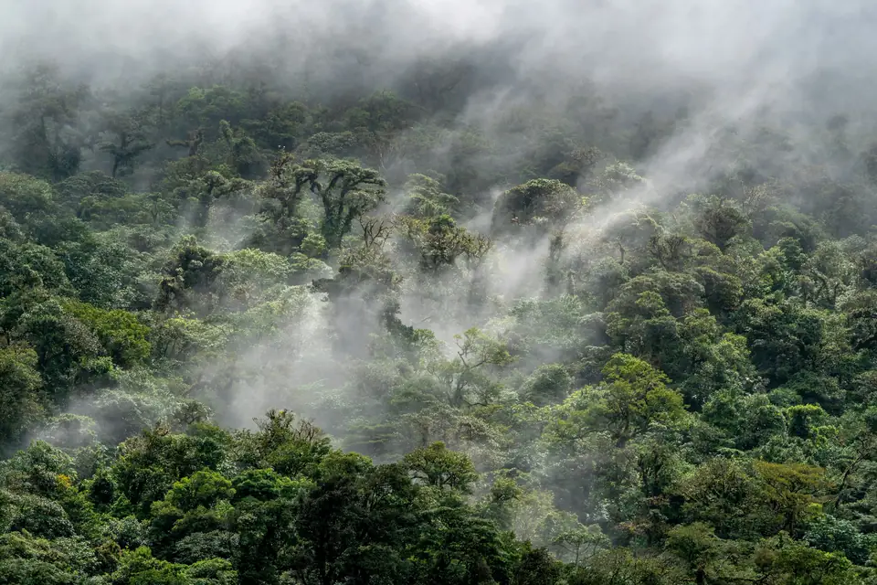
Rainforest in mist seen from above

until the EUDR applies to large and medium companies and to all traders.

Check whether it applies to you

Seven commodities, one cut-off date: 31 December 2020.

From 30 December 2026 cattle, cocoa, coffee, oil palm, rubber, soya and wood, and the products made from them, can enter the EU market only with a due diligence statement. Every statement names the plots where the commodity was produced and shows they have not been deforested since that date.

4 ha
Larger plots need their boundaries as a polygon; for smaller ones a single point is enough.
4%
EU countries must set the maximum fine at no less than 4% of the company's annual EU turnover.
5 years
How long statements, reference numbers and supplier data must be kept.
30.06.2027
Deadline for micro and small companies that place goods on the market themselves.

Based on: Regulation (EU) 2023/1115, as amended by Regulation (EU) 2025/2650.

Who the EUDR affects

Your obligations depend on what you trade, where your goods come from and how large your company is. Three questions are enough to find out.

  1. Commodity
  2. Source
  3. Company size

What do you trade or produce from?

Seven commodities and the products made from them

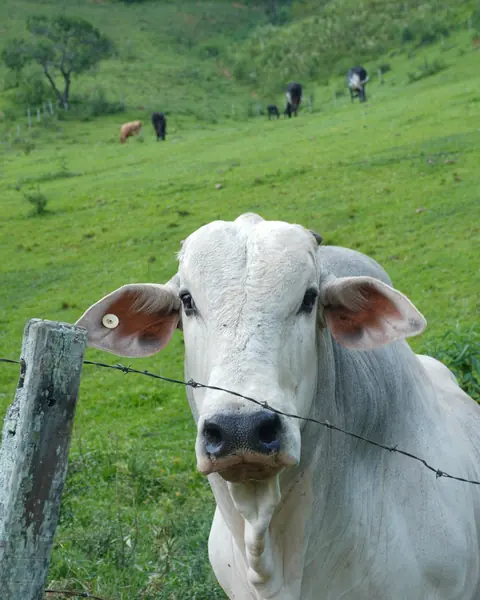
  • A white zebu cow on a pasture
    Photo: Vinícius Costa, Unsplash

    Cattle

    live cattle, beef, offal, meat preparations

    Every farm where the animal was kept counts.

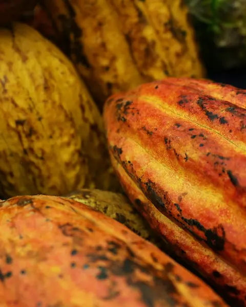
  • Ripe cocoa pods
    Photo: Daniel Dan, Unsplash

    Cocoa

    beans, shells, paste, cocoa butter and powder, chocolate

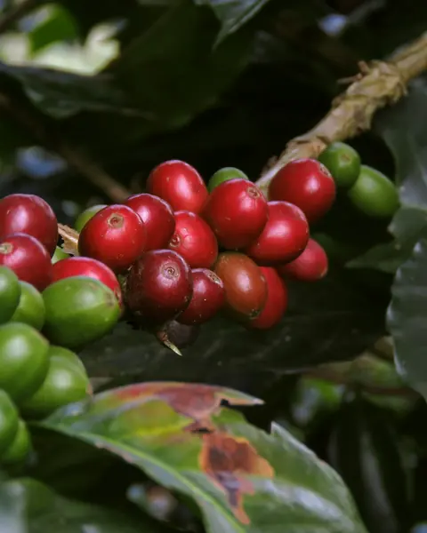
  • Coffee cherries on a branch
    Photo: Andres Hernandez, Unsplash

    Coffee

    green and roasted coffee, husks

    Instant coffee from 30 December 2027.

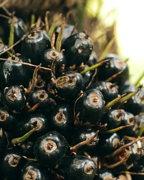
  • Oil palm fruit on the tree
    Photo: Hardingferrent, Unsplash

    Oil palm

    palm and palm kernel oil, fatty acids, glycerol

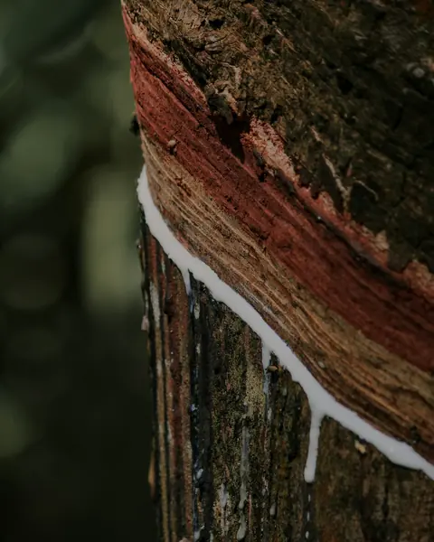
  • A rubber tree trunk with a cut dripping latex
    Photo: Isuru Ranasinha, Unsplash

    Rubber

    natural rubber, compounds, new tyres and inner tubes, gloves

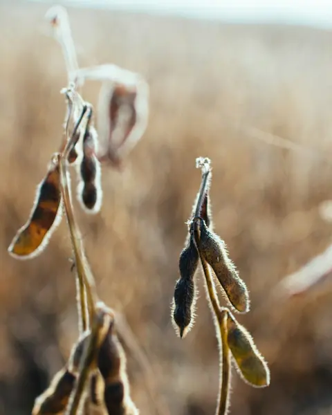
  • Dry soybean pods just before harvest
    Photo: Kelly Sikkema, Unsplash

    Soya

    beans (except for sowing), flour, oil and soybean meal

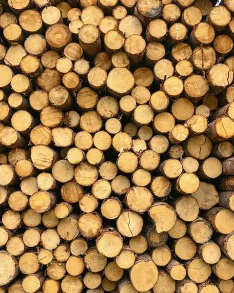
  • A stack of felled logs seen from the cut ends
    Photo: Etienne Girardet, Unsplash

    Wood

    sawn timber, panels, plywood, windows, doors, pallets, furniture, paper, pellets

    Printed matter such as books and newspapers is excluded.

  • The list is closed. From 18 September 2026 cattle hides, among others, were removed from it; from 30 December 2027 instant coffee and further palm oil derivatives will be added.

The panel does most of the work. The decisions stay with you.

Every shipment follows the same path, from the supplier invitation to the statement's reference number. The panel shows what happens on its own and what is waiting for you.

  1. You add a supplier and send an invitation.

  2. Supplier invitation

    A portal in the supplier's language asks for plots, harvest period and documents.

    4 plots received

  3. Data check

    Checks coordinates, the 4 ha rule and missing documents, and reminds the supplier of anything missing.

    1 document missing

  4. Satellite analysis

    Compares every plot with the 2020 forest map and new Sentinel-2 images. About 30 seconds per plot.

    No clearing after 2020

  5. Risk assessment

    Proposes an assessment based on the country of origin, the analysis and the documents.

    Standard risk

  6. You approve it or ask the supplier for an explanation.

  7. Statement to the EU

    Fills in the statement with the plot data and, once sent, passes the number to customs and your customers.

    Ready to submit

  8. You send it with one click.

  9. Archive

    Keeps documents and reports for 5 years. You download the package for an inspection with one click.

    Until 2031

You invite the supplier, approve the risk assessment and send the statement. The panel does the rest.

AI deforestation detection, plot by plot

The model compares every plot with the 2020 forest map and with new satellite images. It finds clearing, measures its area and dates it. Anything that is not clearly fine goes to a person.

Real Sentinel-2 images from the Apuí municipality, Brazil

Analysis result

  • BR-AP-014204.8 ha202.7 ha of forest lost in 2023Forest loss
  • BR-AP-031140.8 ha3.1 ha of change on the imagesTo review
  • BR-AP-027119.5 hano clearing after 2020No signals
  • BR-AP-022140.8 hano clearing after 2020No signals
  • BR-AP-00945.9 hamostly pasture in 2020No signals
The decision is yours

Shipments from plot BR-AP-014 cannot be declared until the supplier explains the result.

Apuí municipality, Amazonas, Brazil (7.47° S, 60.44° W), Sentinel-2 L2A, 10 m. The plots are examples; the results were computed by the same algorithm that runs in the panel.

The same land in 2020 and 2026

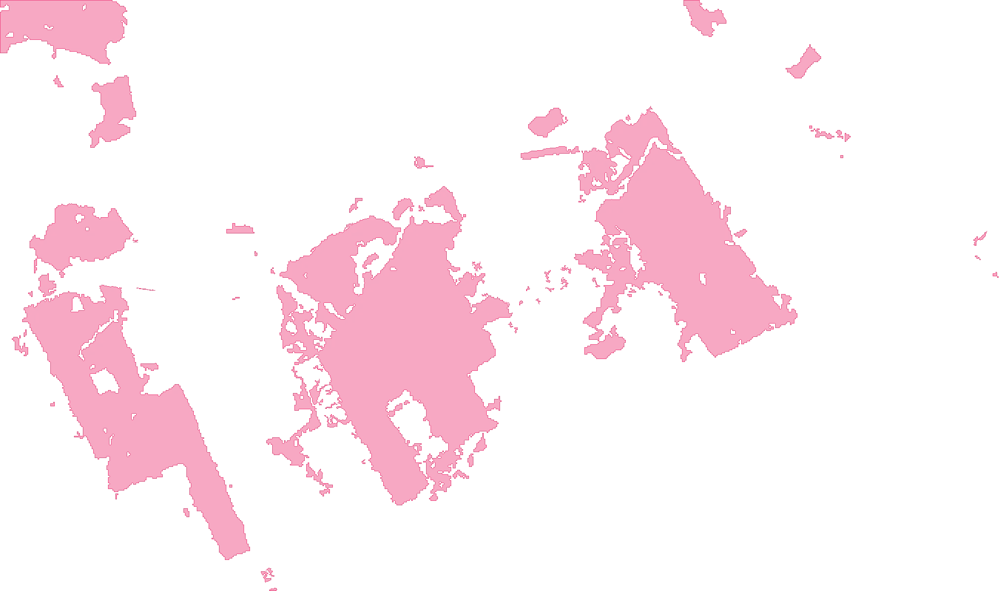
Forest loss in the frame, in hectares

  • 2021671 ha
  • 20221,143 ha
  • 2023791 ha
  • 2024138 ha
  • 2025750 ha
  • 2026*80 ha

3,559 ha in total, 17.8% of the 2020 forest across 208.9 km².

* 2026: Sentinel-2 images only, the yearly data ends in 2025.

The data behind the model
2020 forest map
JRC Global Forest Cover 2020, version 4, 10 m resolution. Produced by the European Commission's Joint Research Centre; supporting, not legally binding.
Tree cover loss 2021–2025
Hansen / University of Maryland, Global Forest Change v1.13, 30 m resolution, yearly data.
Satellite images
Copernicus Sentinel-2 L2A, 10 m resolution. A new image of the same place about every 5 days.
False alarm filters
We compare the same season of the year. Roads, narrow strips and patches smaller than 0.3 ha are discarded.

Tree cover loss does not always mean deforestation in the sense of the EUDR. It can be legal felling, a fire or a replanted plantation. That is why every result other than “no signals” goes to a person, with images from before and after.

Contains modified Copernicus Sentinel data (2020, 2026). Forest map: © European Union, JRC. Tree cover loss: Hansen/UMD/Google/USGS/NASA, CC BY 4.0.

What working in the panel looks like

The dashboard shows first what waits for your decision, then how far along you are and the next customs clearances. The panel does the rest on its own.

  • Supplier portal

    The supplier gets a link and a form in their own language and adds plots as a point or as a boundary file (GeoJSON, KML).

  • Roles and permissions

    Account owner, person approving the risk assessment, view only, for example for your accountant.

  • Change log

    Who approved or sent what, and when. Useful during an inspection.

  • Support access

    Our team sees your data only if you allow it, and only for 24 hours.

EUDR panel pricing

Start with the free plan on five plots. Net prices in Polish złoty (PLN); with annual billing you pay about 17% less.

Free

To try the panel on your own plots, with no contract and no fees.

0PLN/mo

No contract, no card.

No setup fee

Start for free
  • 1 supplier
  • up to 5 plots with satellite analysis
  • 1 user
  • data kept for 30 days
  • no statements sent to the EU Information System
  • Satellite analysis of plots, with a report
  • Supplier portal in the supplier's language
  • Preview of the proposed risk assessment
  • Help: guides and answers to common questions

Start

For small importers and producers buying from a handful of suppliers.

325PLN/mo

390 PLN PLN 3,900 a year

Setup: 1,490 PLN one-time

Choose plan
  • up to 10 suppliers
  • up to 250 plots with satellite analysis
  • up to 50 due diligence statements a year
  • 2 users
  • Supplier portal in the supplier's language
  • Satellite analysis of every plot, with a report
  • Proposed risk assessment for your approval
  • Statements sent to the EU Information System
  • Checks of suppliers' reference numbers
  • Five-year document archive
  • Email support on working days

Business

Recommended for importers

For companies sourcing from many suppliers in several countries.

990PLN/mo

1,190 PLN PLN 11,880 a year

Setup: 3,900 PLN one-time

Choose plan
  • up to 50 suppliers
  • up to 2,500 plots with satellite analysis
  • unlimited due diligence statements
  • 5 users with roles
  • Everything in Start
  • Monthly re-checks of every plot, with alerts
  • One-click document package for inspections
  • Import of suppliers and plots from Excel or CSV
  • Connection to the EU Information System via API
  • Online team training
  • Priority phone support

Enterprise

For groups and companies with complex supply chains.

Custom quote

We agree the scope, integrations and setup after a call.

Setup: custom quote

Let's talk
  • unlimited suppliers and plots
  • several companies in one panel
  • unlimited users
  • Everything in Business
  • ERP integration, e.g. SAP, Comarch, Microsoft Dynamics
  • Sign-in with your company account (SSO)
  • Results reviewed by an analyst
  • Due diligence procedure tailored to your company
  • SLA and a dedicated account manager

Setup covers a scope review (CN codes, role under the EUDR), supplier import, configuration and training. VAT is added where applicable. The panel supports due diligence but does not take over the operator's legal responsibility. We confirm the scope and terms before we start.

Questions we hear most often

What is YourWeb EUDR?

YourWeb EUDR is EUDR compliance software from Poland for Regulation (EU) 2023/1115, made for importers, producers and traders of cattle, cocoa, coffee, oil palm, rubber, soy and wood. Suppliers send their plots in their own language (a point or a GeoJSON or KML file), AI checks every plot on Sentinel-2 satellite images, and the panel prepares the risk assessment and the due diligence statement (DDS), which it submits to TRACES once you approve it. Records are kept for 5 years. There is a free plan to start.

How is YourWeb EUDR different from TRACES?

TRACES is the European Commission's system where a company registers and files due diligence statements (DDS) with plot geolocation. It does not collect data from suppliers and does not check plots. YourWeb EUDR does the work before filing: it collects plots and documents from suppliers, detects deforestation on satellite images, proposes the risk assessment and fills in the statement, and after submission passes the reference number to the customs agent and to customers.

I buy from suppliers within the EU. Does the EUDR apply to me?

Yes. If you buy in the EU and process the goods, you are a downstream operator: you do not submit your own statement, but you record your suppliers and customers and, from a supplier who placed the goods on the EU market, collect the reference numbers of its statements. You keep this data for 5 years. The deadline is 30 December 2026, whatever the size of your company.

The EU is low-risk. What does that change?

For commodities from a low-risk country, simplified due diligence is enough, without a full risk assessment. You still have to collect the geolocation of the plots and submit a statement. Belarus, North Korea, Myanmar and Russia are currently high-risk; Brazil and Indonesia, for example, are standard-risk.

What if a supplier does not provide plot coordinates?

Without them no statement can be submitted and the goods will not clear customs. The panel sends the supplier reminders in their language and shows which shipment is affected. For plots up to 4 ha a single point is enough; larger ones need boundaries.

Does the satellite analysis replace the risk assessment?

No. It is one source of information, if a very strong one: it shows whether forest disappeared from a plot after 2020. The risk assessment is approved by a person who sees the before and after images, the supplier's documents and the country of origin.

How recent are the satellite images?

The Sentinel-2 satellites photograph the same place about every 5 days. The panel picks cloud-free images from recent months and compares them with images from the same season in 2020. In regions with a rainy season this can be harder; the report then says so.

What does the free plan include?

You can try the panel with one supplier and up to five plots, with satellite analysis and a report for each plot. The plan does not send statements to the EU Information System and keeps data for 30 days. Moving to a paid plan keeps everything you have entered.

Do you submit statements on our behalf?

The panel prepares the statement and sends it to the EU Information System once you approve it. Legal responsibility stays with the company submitting the statement, also when an authorised representative does it.

Can my suppliers use the portal in their own language?

Yes. The supplier gets an invitation link and a form in their language, adds plots as a point or a boundary file and uploads documents. Their data is shared only with your company, and they can withdraw consent.

Book a 30‑minute demo

We will show the panel on your commodities and work out your role under the EUDR. No obligation.

  • Online call, about 30 minutes
  • A sample plot analysed live
  • A quote after the call